AERONAV U.S. PLANNING CHART


1 950
₽
Описание
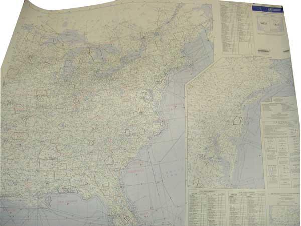
U.S. IFR/VFR Low Altitude Planning Charts is designed for preflight and enroute flight planning for IFR/VFR flights. The chart is printed front-East, back-West, with insets for the east coast from Washington, D.C. to Boston and on the west coast, the Los Angeles/San Diego area. Information includes the depiction of low altitude LF/MF and VHF airways and mileages, navigational facilities, airports, special use airspace areas, cities, time zones, major drainage, a directory of airports with their airspace classification and a mileage table showing great circle distances between major airports, 40 x 36 inches. Revised annually.
Documents
| Арт. | MPN | Описание | Цена | Add to cart form |
|---|---|---|---|---|
| 13-30703
|
USPLANZ
|
U.S PLANNING CHART - FLAT/WALL
|
$
6.50
|
|
| 13-06455
|
USPLAN
|
AERONAV U.S. PLANNING CHART
|
$
6.50
|
Отзывы Оставить отзыв
Вопросы и ответы
Вопросы отсутствуют.
Отзывы ещё не добавлены